Tuesday, April 30, 2013

Zihuatenejo, Mexico


Zihuatenejo, Mexico

After a 48 hour motor/sail north from Huatulco, we arrived in this charming village called Zihuatenejo (pronounced Z-wah-ten-nay-ho).  One item from my bucket list:  stay in a B&B carved out of the side of a rock hanging over the ocean, with rock stairs to a small sandy beach.  Guess what?  That B&B is here!


We immediately met some other cruisers here and they invited us to join them for happy hour and dinner in town. Well, I'm game!  So into town we went.  By the way, most of the anchorages we have been in have a dinghy dock......................well, not in Mexico.  It's "beaching the dinghy", which I will tell you - can be dangerous.  Especially if there is any surf - then you're dead meat and WET!!!! (Put your purse & camera in a baggie!)

Just so happens it was "International Dance Day".   It was exhilarating to see the traditional dancing and hear the traditional music.


Paddy's having a Pacifico in honor of his friends Dave and Kathy on Lightspeed, who are in the Tuamotus, French Polynesia.  Cheers.


We walked to Bandido's for dinner.  They make the salsa at your table with this mortar and pestle.  Ingredients include onions, garlic, salt, HOT peppers, cilantro and tomatillos.  All smashed up.  Needless to say, it was YUMMY!


This is the most elegant presentation of a spinach salad I have ever seen.  The spinach is wrapped/rolled in the thin slice of cucumber, topped with slices of red grapefruit and orange, garnished with very few chucks of bleu cheese, sliced apple and almonds.


Creamed corn soup.................enough said.  You can tell by Kathy's arms, she's impressed!

Paddy's chili relleno with rice and guacamole.

I ordered the grilled tuna (rare!!!) in a balsamic vinegar, mashed potatoes with a homemade potato chip standing in the center and steamed veggies.  Guess what my reaction was???
Sue and Geoff ordered the molejito (sp?), a stew of meat, fish, or shrimp served in the mortar with cilantro and green onions.  

After a few beers and margaritas!

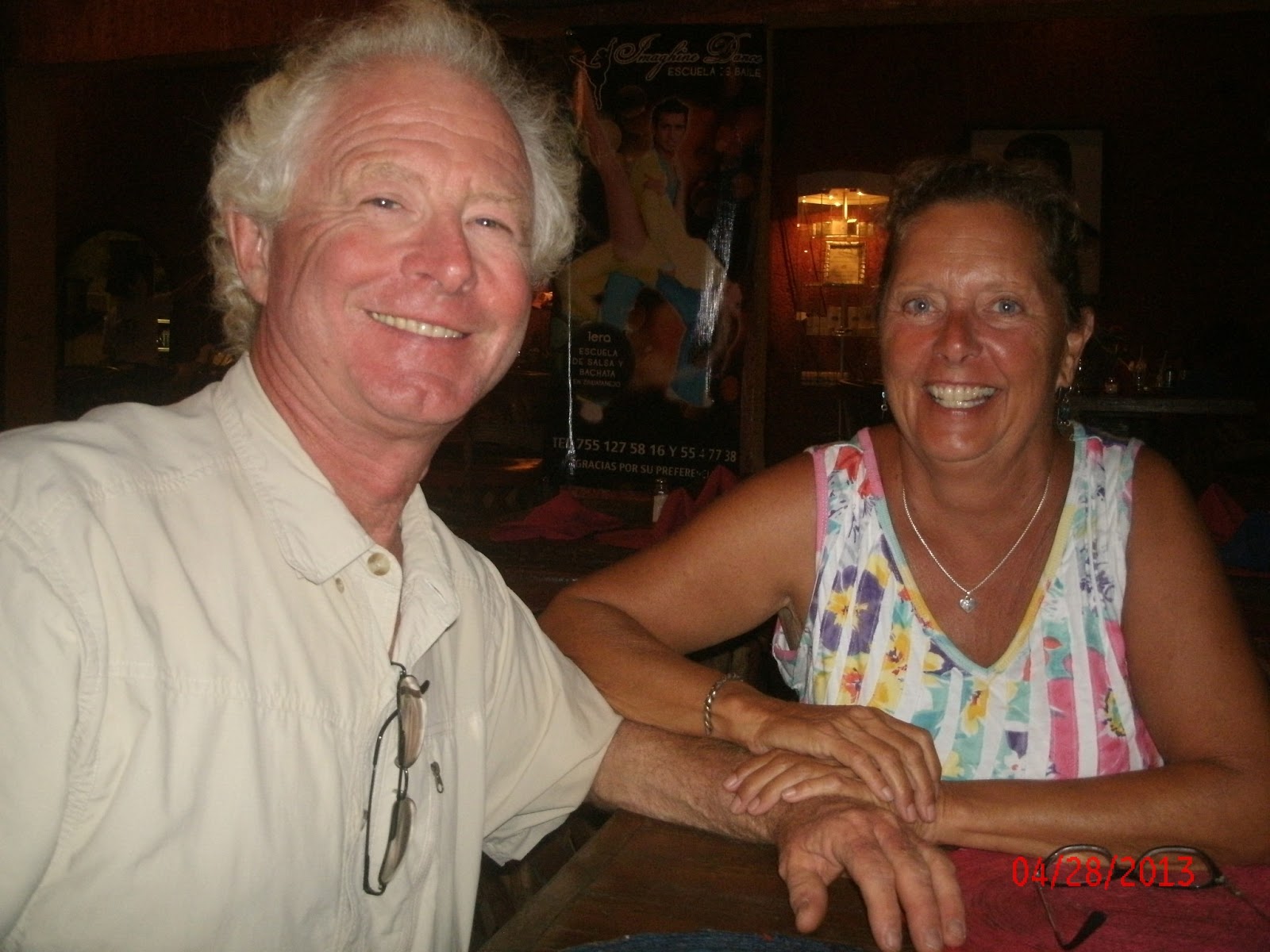
Kathy, Don (Wild Rose), Paddy, the Queen, Sue and Geoff (BlueJacket) at Bandido's.
Decided we need to see the village in the day light.  Here's a parade float being constructed on a pick up.  Something's going on???  It's 10:50 p.m. and there is a lot of music and fireworks on shore.  This is a happening place.
The entrance to a hotel.  Those are shells inlaid in to the floor and the front of the counter.
Typical street
Mexican sunset
Same view with the city lights.

Come to the charming village of Zihautenejo.  Just a few minutes up the coast is Ixpata.  I'll be back.
Adios.

Thursday, April 25, 2013

Hi Tech on the High Seas


HI TECH ON THE HIGH SEAS


When I first decided to join Paddy for this ocean voyage adventure, I wasn’t really thinking too much about “safety”, I just put my life in his hands.  I mean, he HAD already been sailing for 10 years taking him from Oregon down the west coast to Mexico and then onto the South Pacific and Australia, then from Venezuela up through the Caribbean and to Florida.  (He sold his Baltic 42’ in Australia and bought Le Chat Beaute’ in Venezuela.)  So, how could I go wrong with this sailor?  Well, I wasn’t wrong, but have since learned A LOT about what helps to make for successful safe cruising, in addition to a well-qualified sailor.  I AM in good hands.   It’s called technology.

Pre-Bill Gates, Captains would literally plot their course using charts and various navigational tools.  Known as the chart table.  Now with all the electronics on board, I just call it the "mess!" 


We don’t always have internet.  Actually we don’t have it more often then we do.  But there are other pieces of equipment on this boat that provide us with the information necessary to make sailing “safe”.  Of course you need to know ”how and what” to do with the information you gather.
Single-side band radio (SSB) – you can communicate with the world on this radio.  It’s also your main contact link if you need to call “Mayday”.  Every day at certain times there are radio broadcasts which give you local weather and updates.  These broadcasts also give you the opportunity to air any “emergency, medical or priority traffic”.   We have a function that even gives us the ability to send and receive email when we don’t have internet.   Ours is an ICOM IC-M802.  Note:  the red distress bottom top left.

VHF – VHF (Very High Frequency radio) is used for closer proximity broadcasting.  Channel 16 is the main channel as it is monitored by the Coast Guard (when in the states),  local port captains and authorities, and nearby marinas.  Also a Mayday channel.  Story:  When we were in Roatan (and this scenario is common in most large cruising anchorages), we had a local VHF broadcast every morning at 9 a.m.  There is always the call for “emergency, medical or priority traffic”, then the weather, and a call to see who’s listening.  At that time all who wish to do so, call into the radio their boat name and it is acknowledged by the Net (short for network) Controller.  It is the perfect opportunity to ask for information because there are always sailors there that know everything!!!   Like, where’s the best place to get gas?  Where’s the local market?  How far is it to the Port Captain’s office?   What time does Stephen pick up the laundry? (my favorite!)  If there are any social events going on, those would be announced, like Pizza night, movie night, pot luck, Easter dinner, etc.  Everything and anything cruisers need to know.


Charts and GPS  – on our IPAD we have programs with regional charts showing our location, depths, coast line, speed, anchorages, marinas and areas to avoid – i.e. reefs, shoals, rocks, all those things you DON’T want to hit!!!
This photo was taken during our crossing of the Gulf of Tehuantepec, which can be a very dangerous area if the winds are blowing.  The winds were 25 - 35 kts. 2 days before we sailed through.  Today we are motor/sailing because there is NO wind!  Hence, the importance of weather forecasts.

 GPS – we have a hand-held GPS so we can plot our course by entering the lat/long (latitudes and longitudes – for you land lubbers!) to our next destination.  In the case of longer voyages, we enter numerous lat/longs since we may be turning to port or starboard  (left or right land lubbers!).  In the perfect  world,  we prefer to “run the rhum line” which is a straight line from origin to destination.  The GPS also indicates our speed (5.5 kts.), how long we have been at sea (18 hrs, 19 mins.), an approximate time of arrival (on another screen!), and how many miles we have travelled (103).  This tool is always within hands reach.

 Depth Gauge – self-explanatory! lol


EPRIB – Emergency radio information – when activated, it sends out a satellite signal that includes the boat’s name and our personal information that is picked up by the U.S. Coast Guard when we are anywhere in the world.  If they determine that there is an actual emergency, they WILL come look for us. 

  I also have a PLB – personal locator beacon.  Again, once activated it sends my registered information and boat name/location to NOAA .   My going away gift from Gator Dave!  


  AIS - Accident Intervention System – (my other FAV!)  a small laptop is designated for this program.  Imagine looking at a radar screen and in the center, well, there YOU are!  Around you are circles indicating 1, 5, 10, or 20 miles (depending on the zoom in or zoom out feature).  If there are any other ships/boats within those areas, you will have a “flag” where they are, so you know if there is any potential danger of running into them or having a ship run into to YOU!  This program is used for all long distance trips that include night sailing.  Click your mouse on the flag, and that ship’s info will appear.  The name, class (which refers to length – we are Class B.  Class A are the large commercial ships.), speed, direction, and lat/long. ALL Class A vessels are REQUIRED to have the system AIS.  Privately owned sail and motor vessels are not.  But if you choose to have it, you can have the receive only – you can see what’s out there but they can’t see you.  Or send/receive which is what we have so not only can we see them, but they can also see us.   Needless to say, I am always on the 10 p.m. to 2 a.m. watch and I want to know who’s out there and which way they are going.  The AIS was VERY handy in the Panama Canal area as ALL the large ships in the world transit that area, so there are MANY ships awaiting transit of the busiest passage in the world.. (except the REALLY big ships that are too big to go through the canal and have to go around “The Horn”).  Story:  One night while sailing from Roatan to Provedencia with 3 other boats, I noticed “lights” on the port side but maybe a few miles away.  I radioed on the VHF to Patricia (the more experienced sailor) sailing in front of us (for some strange reason the gals always end up with the graveyard shift!)  …… “do you see that ship?”  She hadn’t but to make sure they saw her, she radioed them on the VHF using the information on the AIS,  i.e.  the ship’s name.  They had seen her and but altered their course for the "comfort zone".

 Last, but not least – Auto Pilot  -  I absolutely can’t tell you how important the auto pilot is.  Imagine standing at the helm manually steering the boat…………….ok, maybe you can’t imagine that.  Well, it can be hard work, especially in rough seas and stormy weather.  With the auto pilot you punch in the direction you are heading by degrees, i.e.  270 degrees, due west.  Story:   While on my watch one night, we snagged a fishing trap and line that literally disabled the auto pilot so we were going in completely the opposite direction.  It’s not fail safe, so you do need to check it regularly to make sure you are on course.

Since we are on the fast track to San Diego before hurricane season, we will be covering a lot of territory.  800 miles has already been covered since we left Panama City.  Only another 800 to Cabo San Lucas and then 700 to San Diego.........................yes, ma'am, it's a long trip.   Today we are leaving @ 4 p.m. for Zihuatanejo which is about 350 miles......2.65 days at sea.  


Safety?  Most importantly it’s all about your Captain.  Be assured, I AM in good hands.


Tuesday, April 9, 2013

The Pacific Side


THE FAR SIDE..............A/K/A THE PACIFIC

Always an enjoyable treat is having dolphins swim along the side of the boat.  On our way to the Las Perlas Islands, southeast of Panama City, we were surrounded by at least 100 dolphins.  No joke, 100!!!  AND, for at least 45 minutes!  Everywhere you looked, they were jumping , frolicking and just having a damn good time!

 The sail was easy and only several hours.  Our destination was Isla Contadora, the main and most northern island.  Even though it's the dry season, there was still a lot of healthy vegetation.  Looks like a pineapple tree, right?

 After anchoring, we realized our friends Pepe and Big Bear from BeezNeez were also anchored there.  Now what's that about?  They were supposed to be in the Galapagas!  Well, it's that "plan" thing.  Sometimes it works and sometimes it doesn't!  I hailed them on the VHF, and Pepe said she would swim right over......and she did!  We spent a few days with them and we did the proper amount of giggling!!  It was great to see them.  The day we left, they did also - finally on their way to the Galapagas islands, a 7-10 day sail - determined by Mother Nature.   Love you two.
 Because the Perlas islands are only 30 miles off shore, the islands are obviously the "weekend" destination for the rich Panamanians.  There were MANY awesome homes there, hanging to sides of this hilly island.  Think these folks have a nice view?

Our anchorage beyond the breaking waves.

 Our next port of call was the LeCoiba National Park for  few days and Easter Sunday.  The onto the Las Secas.  We were the only boat there.
 Beautiful water.

A full 24 hour sail then took us to Golfito, where you check in to Costa Rica.  Cute little marinas and a nice village - though somewhat busy.  The first thing I noticed was the cleanliness, and the bright colors used to paint the homes and buildings.  The Costa Ricans, known as Ticas, are very friendly and helpful.
 Bright paint for their boats too!  Modern and traditional here.
 Checking into this country was quite the ordeal, to say the least.  First Immigration, then Customs, and of course to the Capitano de Puerto.  Bring your passports, boat registration, crew list, and your zarape.  What's a zarape, your ask?  It is the document issued by the country you just left, indicating you properly checked in and checked out.  Which in most countries means you paid all the fees.  This process isn't any different from other countries, except in Golfito you are running all over town.  You'd think they could all be closer together, but no............so cab a ride here then a cab ride there!
 Paddy sipping iced tea from a baggie while we waited an hour at Customs. ( An hour wait because their computers were down, so they had to send the clerk to another location with a working computer!)  You bite the tip off one corner and start sucking.  Once you start, you have to finish it because you obviously can't put it down without losing the contents..............kind of like those paper water cones with the pointed bottoms.  Now that's a balancing act.

After leaving Golfito, our next stop was Drakes Bay, with Isla del Cano about 12 miles offshore.  History is that Sir Francis Drake came to the area and then buried his treasures on an island off the coast - and that's Isla del Cano, a/k/a Cane Island.  Over the years, treasure hunters have ruined the island with their diggings, so a group of ecologists talked the government into taking it over to preserve the pristine waters and healthy surroundings.  We went for a 2-tank dive with James and Enrique our dive master.  The water was very murky making the visibility @ 8-10 feet most of the time.  It was eerie.  But we could see enough to know we were swimming with sting rays @ 4 to 5 feet in width.
 The guys set the table on the boat for lunch.....note the lovely tablecloth. 

 Oh yeah, we could see well enough to see this @ 20 foot whale shark.  Talk about BIG!

Friday, March 22, 2013


FROM PORTOBELO THROUGH THE PANAMA CANAL

 The view from the fort of the harbor.
 The Spanish built 2 forts, one on each side of the harbor, and a walled city. 

Portobello - quoting Eric Bauhaus, Cruise Guide author extraordinaire - “The Bay of Portobello was discovered by Christopher Columbus in 1502 and was chosen as the Caribbean transshipment center because of its magnificent harbor and convenient location. From this port tons of gold and silver flowed to the commercial capital of the Spanish empire, Seville. Between 1574 - 1702,  45 fleets of galleons were sent forth, none of which carried less than 30 million pesos of riches. The wealth that arrived was a strong temptation for pirates like Henry Morgan. With his troop of 460 men he took over Portobello and while the defenders tried their best, they were overcome and unsuccessful with their negotiations, they eventually gave in and paid Morgan 100,000 pesos in order for him to not destroy the population.” (thanks Wayne!)

On Sunday, March 10th after a week in Portobelo, we sailed to Shelter Bay Marina to prepare for our passage through the Panama Canal.

This marina is top notch – beautifully tiled restrooms with rain forest shower heads, restaurant, pool, hot tub, mini market and a launderia.  May not sound like a big deal to you, but to me it was HEAVEN!  First things first – laundry.  Five loads.  Next we were awaiting the Admeasurer to measure the boat.
Pedro Lopez, Admeasurer
Then our agent Erick to complete our paperwork with all the vessel info, submit it to the Canal authority so we will then be given a day and time for our passage.    Fortunately, the canal is not that busy now so our dates were Saturday and Sunday, the 16th and 17th.   You are required to provide or hire line handlers.  Our friends Allen and Patricia on Nauti-Nauti joined us for the trip as well as Nicole a nice Austrian gal we met in the marina.
The hungry crew!
Tires hanging are the fenders required!  Attractive, hey?

Colon is the nearest town to get cash and provisions, i.e. food and beer!  The marina provides a free shuttle bus daily for the 30-40 minute ride into Quartro Altos Mall.  So off we go.  It’s a beautiful drive through the jungle once we depart the marina property which is on the abandoned military base, Ft. Sherman.  There are now a few new buildings under construction for barracks and administration as there are humanitarian troops here to aid in the construction of schools in Panama.  The road crosses the canal – a swing bridge that is just above water level is used when the locks have been closed.  Depending on the number of ships going through, you could have quite a long wait for the bridge!
 Here we go..........sharing a lock with a big freighter.
 The lines are from the boat to the top of the lock.  As the water recedes, you let out the line, and pull in the lines when the water enters the locks.
 Our helpful Advisor, Francisco, napping! lol
 Locks closing behind us.
Dave Wood saw us on the canal's live cam.  There we are tied up to a mono hull, L'Espirit de la Mer.
VERY COOL

A little history lesson:  “There are mountains but there are also hands, and for the king of Spain few things are impossible.”  This was the imaginative rationale of a Catholic priest in 1534, after having studied the feasibility of a canal through the isthmus of Panama.  Presumably wiser minds prevailed, as King Charles V of Spain realized that picks and shovels were wholly inadequate (duh?).  Instead, the Spanish did pave extensive cobblestone mule trails over which tons of gold from the conquest of Peru traveled on their way to Spain……..it’s always about the MONEY!  In 1850 construction began on the Panama Railway with 10,000 casualties and $8 million later.  The railway was successful but the Colombian government granted a French company the exclusive privilege, valid for 99 years, to construct a waterway across the isthmus of Panama.  The considerable skills of the French engineers could not overcome the diseases or the harsh geographic and climatic conditions they encountered, nor the fiscal mismanagement that brought the enterprise to ruin in 1889.  In 1894 a second French company emerged to resume work on the canal but due to lack of funds from the French government they were forced into bankruptcy.  They sold their rights, ownership and equipment to the United States.    In 1903, following Panama’s declaration of independence from Colombia, Panama and the U.S. signed the Hay-Bunau-Varilla Treaty.  It took 10 years, labor of 75,000 men and women and @ $400 million to complete the task.  As you can imagine, the builders faced unprecedented problems:  geology, enormity of the locks, excavation (where do we put all the dirt?), establishing new communities to house the workers, importing all the equipment and supplies down to the nails, and tropical diseases.  Colonel Williams Crawford Gorgas and his  medical team are credited with eradicating yellow fever and bringing malaria under control.  The canal opened to traffic on August 15, 1914.
The new canals and locks under construction are mainly for the use of Panamax ships – which are so big they are unable to go through the present canal – and must go around Cape Horn.  Lots of money and time will be saved.  Scheduled to open 2014-2015.   Plan your cruise NOW!!!
Enough of that.

 Unusual architecture in Panama City (Guess jeans billboard).  The women in Central America wear the tightest jeans I have ever seen (more like leggings)and the tallest heels. Short, tall, thin, fat - they all wear them!!!  Don't know how they do it in this heat.  The men.......blah!   Saw a cute 15 year old!

I found the city of Panama, population @ 1 million, very attractive, high energy and booming.  There is mucho construction going on downtown.  They have a Trump Tower and a Hard Rock Hotel.  Very metropolitan.   Oh, and traffic to match the chaos.  Most of the businesses close at lunch time, and for some dumb reason, everyone gets in their autos.  Go take a nap and stay away from the traffic until after lunch.


.Another BIG shop.  There's an escalator to accommodate the shopping cart down to the parking garage!
(NOTE:  4 cases of beer on the bottom!)

In the next day or so,  we will go south @ 30 miles to the Las Perlas Islands where we hope to do some diving.  By the way, the water is COLD here!  Then we’ll start banging our way up the coast of Panama to Costa Rica, Mexico and finally California.